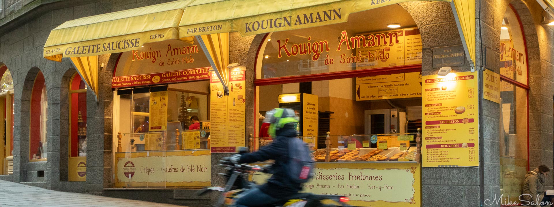
![Medieval Saint-Malo may have been built to resist sieges, but I suspect its greatest threat now comes from butter. Between the galettes, crêpes, far breton and the famously rich kouign-amann displayed in the window, this corner of the old walled city offered a formidable challenge to any traveller attempting dietary restraint. [5142] Medieval Saint-Malo may have been built to resist sieges, but I suspect its greatest threat now comes from butter. Between the galettes, crêpes, far breton and the famously rich kouign-amann displayed in the window, this corner of the old walled city offered a formidable challenge to any traveller attempting dietary restraint. [5142]](2020Brittany/splash.jpg)

Medieval Saint-Malo may have been built to resist sieges, but I suspect its greatest threat now comes from butter. Between the galettes, crêpes, far breton and the famously rich kouign-amann displayed in the window, this corner of the old walled city offered a formidable challenge to any traveller attempting dietary restraint. [5142]
Jutting into the Atlantic at the far north-western corner of France, Bretagne, known in English as Brittany, is both an administrative region and a cultural homeland with a character distinct from the rest of the country. The modern administrative region comprises the four departments of Finistère, Côtes-d'Armor, Morbihan and Ille-et-Vilaine, with Rennes as its capital. Historically, however, Brittany also included Loire-Atlantique and the city of Nantes, which today lie outside the official region. Depending on whether one speaks of administrative or historical Brittany, the population ranges from about 3.5 million to almost 5 million people.
The peninsula was known in Roman times as Armorica, a name thought to derive from a Celtic phrase meaning "land by the sea". Following the collapse of Roman power in Britain, waves of Celtic-speaking migrants crossed the Channel from what are now Wales and Cornwall, bringing their language and traditions to Armorica and ultimately giving Brittany both its name and much of its distinctive identity, creating a Little Britain. While French has long since taken over in everyday life and their ancient Celtic tongue, Breton, has sadly faded from common use, it still lingers visibly across the region on bilingual road signs and town markers.
For much of the Middle Ages, Brittany existed as an independent kingdom and later a duchy, maintaining a degree of autonomy before becoming permanently united with France in 1532. Yet even today the region retains a strong sense of identity expressed through its language, music, festivals, flag, and maritime traditions. To many Bretons, Brittany is more than an administrative boundary; it is a historic nation within France.
Travellers today, such as us, encounter a region of rugged granite coasts, fishing ports, medieval towns, tidal estuaries and windswept headlands. Yet beneath the scenery lies a deeper continuity. From the megalith builders of Carnac and Barnenez, through the seafaring Bretons of the Middle Ages, to the modern communities of France's Atlantic coast, Brittany's enduring identity has always been shaped by the sea.
Across Brittany, every signpost reads like a compressed history lesson, where ancient Gaulish tribes, wandering 6th-century Celtic saints, and blunt maritime geography have quietly survived centuries of French cartography to reward anyone curious enough to ask what a name actually means. The toponymy
Why did we decide to do a road trip around Brittany? And why do it in Winter? Well, basically we had two destinations on a bucket list, more or less at the opposite ends of the region. To the south, there is Belle-Isle-en-Mer, an island we knew to be beautiful and whose panoramic image lives on our bedroom wall at home. And to the north there is Saint Malo, a place we knew mostly from the novel All the Light We Cannot See by American author Anthony Doerr set there in World War II. And's that's not to mention the other irresistable attraction of Mont Saint-Michel
The map shows our basic route, as we originally intended it, undertaken clockwise, which Google calculated as 884km or just over 14h, plus the return to Rennes. Hardly an intensive drive, even when you add on just exploring and "driving around", given that it ws spread over almost a full month! Serious driving in country Australia would cover that distance in one or two days. And the map exposes any claim that we have "done Brittany" as a fallacy. We did nothing to explore towns away from the coast, which (those few we passed) look quite interesting and very Breton, not to mention the Amorique National Park. There is always reason to come back!
This page is a reimagining of the Travel Blog of our road trip around Brittany in January 2020 but with some new images and retrospective commentary. The original Travel Blog is more like a daily diary and was published contemporaneously with off-the-cuff captioning and rushed post-production of the images. (To see the Blog, click the square icon at the right.) Retirement, and more spare time, has allowed me the luxury of doing more work to make the photos presentable, and quite some research into the back-stories of where we were, including an understanding how places got their names, which I now understand is called toponymy.
Every road trip needs a starting point, and ours began in Rennes
Brittany's story stretches back far beyond written history. The region around Quiberon
For many travellers, Brittany is a journey of coastal towns and stone villages, yet for us, the entire 2020 road trip revolved around a single destination: Belle-Île-en-Mer
Nestled along the scenic south coast of Finistère in Brittany, Concarneau
From the dramatic, wave-lashed extremity of Pointe du Raz
Resting on the tip of the Crozon Peninsula, Camaret-sur-Mer
Skirting straight through the bustling naval city of Brest without stopping, we headed west to the rugged headland of Plougonvelin
Moving east but driving well away from Brittany's northern coast, we arrived in Morlaix
Continuing eastward along the Emerald Coast, we reached the legendary fortified port of Saint-Malo
Before arriving, our imagination had already been captured by Anthony Doerr's Pulitzer Prize-winning novel All the Light We Cannot See. Its blind heroine, Marie-Laure LeBlanc, flees wartime Paris with her father and finds refuge within Saint-Malo's ancient walls, only to become trapped there as the city endures one of the most destructive episodes in its long history: during August 1944, Allied bombing intended to dislodge German defenders reduced much of the walled city to rubble. We regard this novel as one of the most moving we have ever read, a fictional drama wrapped around these horrifying facts. Yet remarkably, the Intra-Muros district was painstakingly reconstructed by France after the war, using thousands of salvaged stones and traditional methods to recreate the historic streetscape.
The result is a place that feels both ancient and surprisingly recent. Walking the full circuit of the ramparts several times during our stay, we looked across tide-scoured islands, Vauban's offshore forts and the ever-changing waters of the English Channel. Few places in Brittany convey such a vivid sense of layered history, where medieval merchants, royal privateers, military engineers, wartime civilians and modern tourists have all occupied the same narrow strip of granite jutting into the sea.
With our rental-car return in Rennes looming, we could not resist slipping just across the regional border into Normandy for an unforgettable finale at Mont-Saint-Michel. Rising like a medieval mirage from the vast tidal flats where Brittany meets Normandy, the abbey-crowned granite island has drawn pilgrims for over a millennium, and we were fortunate enough to secure a hotel room whose picture window framed an uninterrupted view directly across the bay to the Mount. We could watch the shifting light and some of Europe's fastest, highest tides transform its silhouette from dawn until after dark.
The river Couesnon flows into the bay beside Mont-Saint-Michel and has played an unexpected role in preserving the famous island. By the late 1900s, centuries of land reclamation, river engineering and causeway construction had allowed sand and silt to accumulate, threatening to attach the Mont permanently to the mainland. A modern barrage, completed in 2009, now uses carefully controlled releases of water from the Couesnon to help flush sediment back towards the sea, helping preserve the Mont's historic maritime character.
Finally after three days and nights enjoying Mont-Saint-Michel, seeing high and low tide, in good and bad weather, quite reluctantly, we turned south for Rennes, for this stop marked the end of our road trip around the Brittany coast.